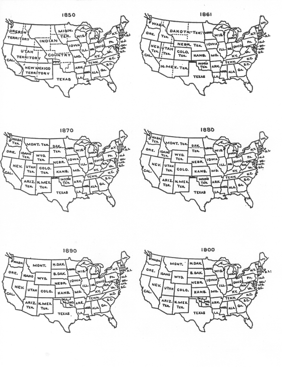
State Maps, 1850-1900
These maps show the changing state and territory boundaries in the contiguous United States from 1850, the first year for which IPUMS data are available, through 1900, the last year with internal boundaries different from current boundaries.
For historical state boundary files, see the National Historical Geographic Information System (NHGIS), another IPUMS project.
Supported By
![]()
![]()
![]()
![]()
![]()